A Warm Winter, a Thin Snowpack: How 2025–26 Is Shifting the West’s Water Calendar
Winter as the West’s water savings account
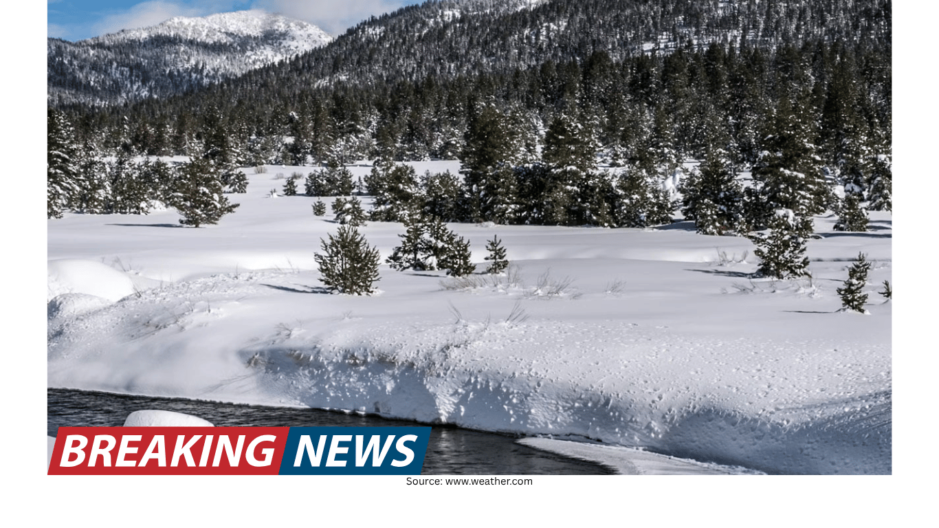
In much of the western United States, winter has traditionally functioned as a kind of natural savings account. Snow accumulates in mountain ranges for months, storing water in frozen form until late spring and summer. That slow release helps feed rivers and reservoirs through the long, dry season, supporting farms, homes, ecosystems and the broader economy.
For decades, water managers have relied on a simple but powerful benchmark to estimate what is “in the bank”: the April 1 snowpack measurement. It has been widely treated as the single most important number in western water management, a proxy for how much water the mountains are holding in reserve as the region heads toward summer.
The winter of 2025–26, however, offered a stark reminder that this familiar rhythm is changing. Instead of building a robust snowpack that can be drawn down gradually, the West entered spring with a savings account that was, by many measures, severely depleted.
Record warmth and a snowpack that never arrived
Across the western United States, temperatures from November through February ranked among the warmest on record. Many areas ran 5 to 10 degrees Fahrenheit (2.8 to 5.5 degrees Celsius) above the 20th-century average. March continued to break heat records, reinforcing conditions that made it difficult for snow to accumulate and persist.
By April 1, California’s snowpack stood at just 18% of normal. The broader western picture was similarly troubling: the total area of the West with snow cover was exceptionally low compared with the rest of the 21st century.
Warmth mattered not only because it reduced snow accumulation, but because it changed the form and timing of precipitation. At lower elevations, higher temperatures meant a significant portion of winter precipitation fell as rain rather than snow. In other places, snow did fall, but warm periods caused it to melt quickly, preventing the steady buildup that water planners depend on.
Why “normal precipitation” did not translate into normal snowpack
One of the defining features of 2025–26 was that low snowpack did not necessarily require widespread precipitation deficits. Even regions that received near- or above-normal precipitation for the season failed to build substantial snow reserves. The reason was straightforward: when temperatures are persistently warm, precipitation that might once have become stored mountain snow instead becomes immediate runoff.
In the northern Rockies and the mountains of the Pacific Northwest, any above-average snow accumulation was largely confined to the highest elevations. Middle and lower elevations carried relatively little snowpack. This elevational divide is increasingly associated with warming winters: as temperatures rise, the freezing line—the boundary where precipitation shifts from rain to snow—moves higher up the mountains. That shift shrinks the area capable of sustaining a seasonal snowpack.
By March 30, 2026, snow-water equivalent at the vast majority of U.S. Natural Resources Conservation Service snow measurement stations across the West was less than 50% of the 1991–2020 median. In practical terms, that meant many basins were headed into spring with far less stored water than communities and ecosystems have historically relied on.
The hydrograph is changing: water arriving earlier, fading sooner
The implications of a warm winter show up not only in mountain surveys, but in the timing of water moving through rivers. Scientists who study natural water flows watch hydrographs—charts that show how much water flows through streams over the course of a year—to understand when water is strongest in mountain streams and how long it is likely to last into summer.
The winter of 2025–26 provided a clear preview of how the regional water cycle in a warmer climate may increasingly behave: less snow, more runoff in winter and early spring, and a reshaping of the hydrograph for snowmelt-dominated rivers.
In multiple river basins across the West, streamflows were above average in winter and early spring, with some locations approaching record-high levels. Historically, a significant portion of that water would have remained locked in snowpack until late spring. Instead, precipitation arriving as rain—combined with intermittent midwinter melting events—pushed more water into rivers earlier than usual.
From one big spring pulse to multiple winter peaks
In recent years, rising temperatures have contributed to a redistribution of streamflows through winter and early spring that is fundamentally reshaping hydrographs. Rather than a single dominant peak during late spring or early summer, smaller peaks can emerge in winter and early spring. At the same time, the traditional snowmelt pulse—relied on to help fill reservoirs in late spring—weakens.
In effect, the hydrograph is flattening. The winter of 2025–26 illustrates what that flattening can look like in real time: higher early-season streamflows can signal less runoff later in the year, when communities, farms and wildlife often need it most.
This is not simply a matter of shifting dates on a calendar. A system built around predictable snow storage and a later release becomes harder to manage when more water arrives earlier, sometimes in bursts, and less remains for the hottest months.
The Colorado River Basin: high stakes in a stressed system
Nowhere do the combined pressures of record warmth, depleted snowpack and altered hydrology carry higher stakes than in the Colorado River Basin. More than 40 million people in seven states plus Mexico, along with 5.5 million acres of farmland, depend on the river’s water. Yet the river’s flow is no longer meeting demand.
In 2026, the April-through-July runoff into Lake Powell—the reservoir behind Glen Canyon Dam and the primary index of the Upper Colorado River Basin’s annual water budget—was forecast to rank among the lowest in recent decades. It was tracking close to 2002 and 2021, years that have been treated as benchmarks of western drought.
Unless spring brought substantial late-season snowfall to the high mountains, 2026 risked joining those years as another marker of how thin the margin between supply and demand has become in a river system already under sustained stress from two decades of drought and water overuse.
Low reservoir levels and low snowpack in the basin have added to fears of water shortages at a time when the seven states that rely on the Colorado River are struggling to reach a new water use agreement. In other words, the hydrology is shifting while the policy framework is still being renegotiated—an uneasy overlap for a system with little room for error.
Two realities the winter of 2025–26 made hard to ignore
The winter of 2025–26 highlighted two emerging realities for the West.
Temperature is increasingly dominating precipitation in determining water supplies. Even above-normal precipitation cannot compensate for persistent warmth when it falls as rain rather than snow, or when it accelerates snowmelt in the mountains.
Streamflow patterns are shifting in ways that complicate water management. Earlier runoff, elevated winter flows and weaker late-spring snowmelt pulses make it more difficult to synchronize reservoir operations with the timing of water availability.
More winter runoff can bring new risks
When precipitation falls as rain, or when rain lands on existing snowpack, the consequences can arrive quickly. Rain-on-snow events can produce flooding in winter, as the Seattle area experienced in late December 2025. These events underscore that warmer winters do not simply reduce snow; they can also intensify certain kinds of winter hazards by turning what would have been stored water into rapid runoff.
At the other end of the year, a low snowpack can mean less runoff in summer, exacerbating water shortages and increasing wildfire risk as landscapes dry out. Even in years with normal precipitation, if more falls as rain or snow melts earlier, evaporation through summer in a warmer climate can leave less water in the system.
What this means for reservoirs and planning
The trends visible in 2025–26—snowpack declines, earlier runoff, elevated winter flows and flattened hydrographs—are consistent with long-standing projections for the western United States as global temperatures rise. What made this winter notable was how clearly those signals appeared even without widespread precipitation deficits.
For water managers, the challenge is increasingly about timing as much as volume. Capturing earlier runoff while preserving water for longer dry seasons can require more adaptive reservoir operations: the ability to adjust storage and release decisions in real time. Yet that flexibility has to be balanced with another requirement—maintaining space in reservoirs for flood control during wetter winters and high-runoff events.
This is the operational dilemma of a warming West: more water can arrive earlier, sometimes in winter surges, while the need for reliable supply often peaks later, during summer heat and dryness. The traditional expectation that mountain snow will hold water until it is needed is becoming less dependable.
A changing seasonal rhythm
The April 1 snowpack number has long served as a shorthand for the West’s water outlook. In 2026, it also served as a warning signal. With California’s snowpack at 18% of normal and much of the West showing snow-water equivalent below half of the 1991–2020 median at many measurement stations, the region saw how quickly record warmth can rewrite the expected pattern of storage and release.
The winter of 2025–26 did not merely deliver an unusually low snowpack. It illustrated a broader shift: a West where temperature increasingly determines whether precipitation is saved for summer or spent immediately in winter runoff, and where river flows may peak earlier and fade sooner.
For communities across the region, the takeaway is not just about one winter’s measurements. It is about a growing reality that the familiar seasonal rhythm of mountain water—snow building quietly through winter, then melting steadily into summer—is changing in ways that will continue to test water supply planning, reservoir operations and the balance between flood risk and drought risk.